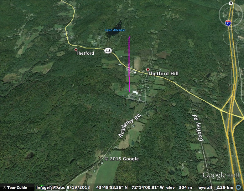
Flight Data
2021-10-17 18:03:13 by jalbert

Image of Flight Path
(click to enlarge)
.kml file (right click, save as ... or option-click on a Mac)
ALTAIR 13
Launched on June 28, 2014.Spreadsheet data: (.html) (.xls).

Image of Flight Path
(click to enlarge)
.kml file (right click, save as ... or option-click on a Mac)
ALTAIR 12
Launched on May 18, 2014.Spreadsheet data: (.html) (.xls). Onboard video.

Image of Flight Path
(click to enlarge)
.kml file (right click, save as ... or option-click on a Mac) ALTAIR 11 Launched on October 12, 2013.
Imagery obtained.

Image of Flight Path
(click to enlarge)
.kml file (right click, save as ... or option-click on a Mac) ALTAIR 10
Launched on August 11, 2013.

Image of Flight Path
(click to enlarge)
.kml file (right click, save as ... or option-click on a Mac)
ALTAIR 9 (tethered balloon drop tests)
Four drop tests on August 7, 2013.Spreadsheet data: (.html1, .html2, .html3, .html4) (.xls1, .xls2, .xls3, .xls4)


Images of Flight Paths
(click to enlarge)
.kml1, .kml2, .kml3, .kml4 files (right click, save as ... or option-click on a Mac)
ALTAIR 8
Launched on June 30, 2013.Drop test on June 12, 2013.
Spreadsheet data: (.html) (.xls)

Image of Flight Path
(click to enlarge)
.kml file (right click, save as ... or option-click on a Mac)
ALTAIR 7
Launched on June 9, 2013.Spreadsheet data: (.html) (.xls)

Image of Flight Path
(click to enlarge)
.kml file (right click, save as ... or option-click on a Mac)

Image of Flight Path
(click to enlarge)
.kml file (right click, save as ... or option-click on a Mac)
GreenCube-ALTAIR Geiger Board Flight
Launched on May 19, 2013.Data available here.
ALTAIR 5A
Launched on December 11, 2012.Imagery obtained.
ALTAIR 5
Launched on October 13, 2012.
Image of Flight Path
(click to enlarge)
.kml file (right click, save as ... or option-click on a Mac)
ALTAIR 4
Launched on August 23, 2012.Spreadsheet data: (.html) (.xls)

Image of Flight Path
(click to enlarge)
.kml file (right click, save as ... or option-click on a Mac)
ALTAIR 3
Launched on July 14, 2012.
Spreadsheet data: (.html) (.xls)


Pitch Attitude Altitude vs. Time Image of Flight Path
(click to enlarge)
.kml file (right click, save as ... or option-click on a Mac)
Launched on April 11, 2012.


Altitude vs. Time Flight Path
(click to enlarge)
(click to enlarge)
.kml file (right click, save as ... or option-click on a Mac)
ALTAIR 1
(.html) (.xls) Ascent data taken by Woomera from Whitefield
(.html) (.xls) Descent data taken by Woomera from Whitefield. Much of this shows the period when GPS was over its altitude limit
(.html) (.xls) Descent data taken by Goldstone from North Sandwich.

Image of Flight Path
(click to enlarge)
.kml file (right click, save as ... or option-click on a Mac)
_____________________________________________________________________________
Launched on September 2, 2011.
Spreadsheet data:(.html) (.xls) Ascent data taken by Woomera from Whitefield
(.html) (.xls) Descent data taken by Woomera from Whitefield. Much of this shows the period when GPS was over its altitude limit
(.html) (.xls) Descent data taken by Goldstone from North Sandwich.

Image of Flight Path
(click to enlarge)
.kml file (right click, save as ... or option-click on a Mac)
_____________________________________________________________________________
ALTAIR Flight DataALTAIR 2, Flight Path.kmlA6-FlightData.html


